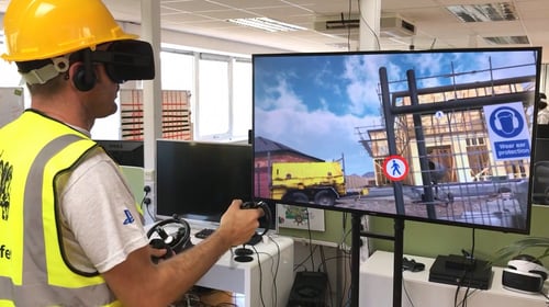
Our commitment to innovation and cutting-edge technology sets us apart, allowing us to reshape how projects are executed. By leveraging advanced tools and processes, we consistently deliver unparalleled value to our clients.
Embrace a commitment to Lean principles by leveraging technology for sustainability, efficiency and continuous improvement.
Create value for clients by streamlining project processes and reduce costs through efficient construction practices and technology integration.
Emphasize integration of preconstruction and construction phases for seamless planning and execution optimization.
Our Model-to-Field process seamlessly connects digital design with onsite construction activities. It involves rigorous coordination, clash resolution, and the transformation of digital models into construction documentation, ensuring precise guidance for onsite teams. Incorporating 4D scheduling, survey data, and continuous updates, this process enhances collaboration, reduces errors, and optimizes efficiency and cost-effectiveness throughout construction projects.
Our specialized technology brings insights to your construction projects, offering enhanced decision-making capabilities, cost savings, and streamlined project management, helping to ensure your project's success.

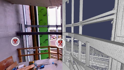
Our construction projects leverage advanced Reality Capture technologies, such as 3D LiDAR Scanning for precise 3D models documenting existing conditions, and Photogrammetry techniques transforming 2D images into detailed 3D models.
We utilize 360° Progress Photos to create a comprehensive visual history of project evolution, facilitating project management and decision-making. Aerial Photography from drones provide a bird's-eye view for progress monitoring, challenge identification, and effective communication with clients and team members.


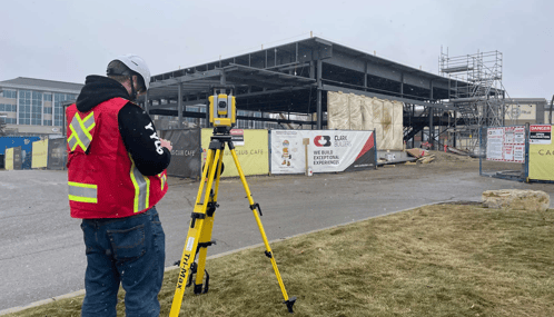
We leverage state-of-the-art robotic total stations to perform precise on-site layout tasks directly from the digital model. This not only enhances accuracy but also accelerates the construction process, minimizing costly rework and delays.
.jpg?width=500&height=281&name=4.%20Integration%20%26%20Coordination%20(1).jpg)
Our VDC system enables a thorough comparison between as-built elements and the original design intent. This in-depth analysis identifies discrepancies early in the construction process, ensuring your projects adhere to the highest quality standards and minimizing the likelihood of costly post-construction modifications.
-1.jpeg?width=500&height=281&name=Drone%20(1)-1.jpeg)

Our construction projects leverage advanced Reality Capture technologies, such as 3D LiDAR Scanning for precise 3D models documenting existing conditions, and Photogrammetry techniques transforming 2D images into detailed 3D models.
We utilize 360° Progress Photos to create a comprehensive visual history of project evolution, facilitating project management and decision-making. Aerial Photography from drones provide a bird's-eye view for progress monitoring, challenge identification, and effective communication with clients and team members.


We leverage state-of-the-art robotic total stations to perform precise on-site layout tasks directly from the digital model. This not only enhances accuracy but also accelerates the construction process, minimizing costly rework and delays.
.jpg?width=500&height=281&name=4.%20Integration%20%26%20Coordination%20(1).jpg)
Our VDC system enables a thorough comparison between as-built elements and the original design intent. This in-depth analysis identifies discrepancies early in the construction process, ensuring your projects adhere to the highest quality standards and minimizing the likelihood of costly post-construction modifications.
-1.jpeg?width=500&height=281&name=Drone%20(1)-1.jpeg)
Clark Builders recognizes that we live, work, and build across Canada on the ancestral lands of many First Nation, Métis, and Inuit communities. We also recognize the collective legitimacy of Aboriginal rights and title, and respect the diversity between and among First Nation, Métis, and Inuit across this nation. We value the contributions of Indigenous people as stewards of the lands we share, and we are committed to our role in the journey towards Truth and Reconciliation.
Privacy Policy | Code of Ethics | ©2025 Clark Builders, All rights reserved.